
Key Takeaways
- The floodwall is a 1964 Corps project the City now runs: The City has maintained the 8,460-foot levee system since 2008, with five closures and two pump stations (City of Cape Girardeau).
- River stage drives the city's response: Flood stage is 32 feet, the record crest was 48.86 feet on January 2, 2016, and the system is built to protect to a 54-foot stage.
- The wall does not set your flood zone: FEMA's flood map does, parcel by parcel. Check your address at the FEMA Flood Map Service Center.
- The 50 percent rule shapes a buyer's repair plan: Work that reaches half the market value over ten years triggers the elevation standard in A and AE zones (Sec. 12-4, Sec. 12-63(1)).
- Share what you know: Missouri has no general disclosure form statute, but known flood history and water damage should go to the buyer in writing.
- You can sell as-is: No rule makes you repair or elevate before a sale. A direct cash buyer can price the flood questions into one offer.
If you want to sell a house in a flood zone in Cape Girardeau, Missouri, the first step is a calm one. Look up your address on FEMA's flood map, then learn the few city rules a buyer will ask about. The Mississippi River floodwall protects downtown, but it does not decide how a lender, an insurer, or the city's floodplain code treats your house.
This guide covers how the floodwall works and what happens at each river stage. It also explains how to read your Cape Girardeau floodplain zone, the city's 50 percent rule, flood insurance basics, and flood disclosure in Missouri. It ends with practical ways to sell.
Why wait? Sell your house “as is” for cash today
Tell us about your house. We'll make you a cash offer based on local market data.
Let's chatWhat Does the Cape Girardeau Floodwall Protect?
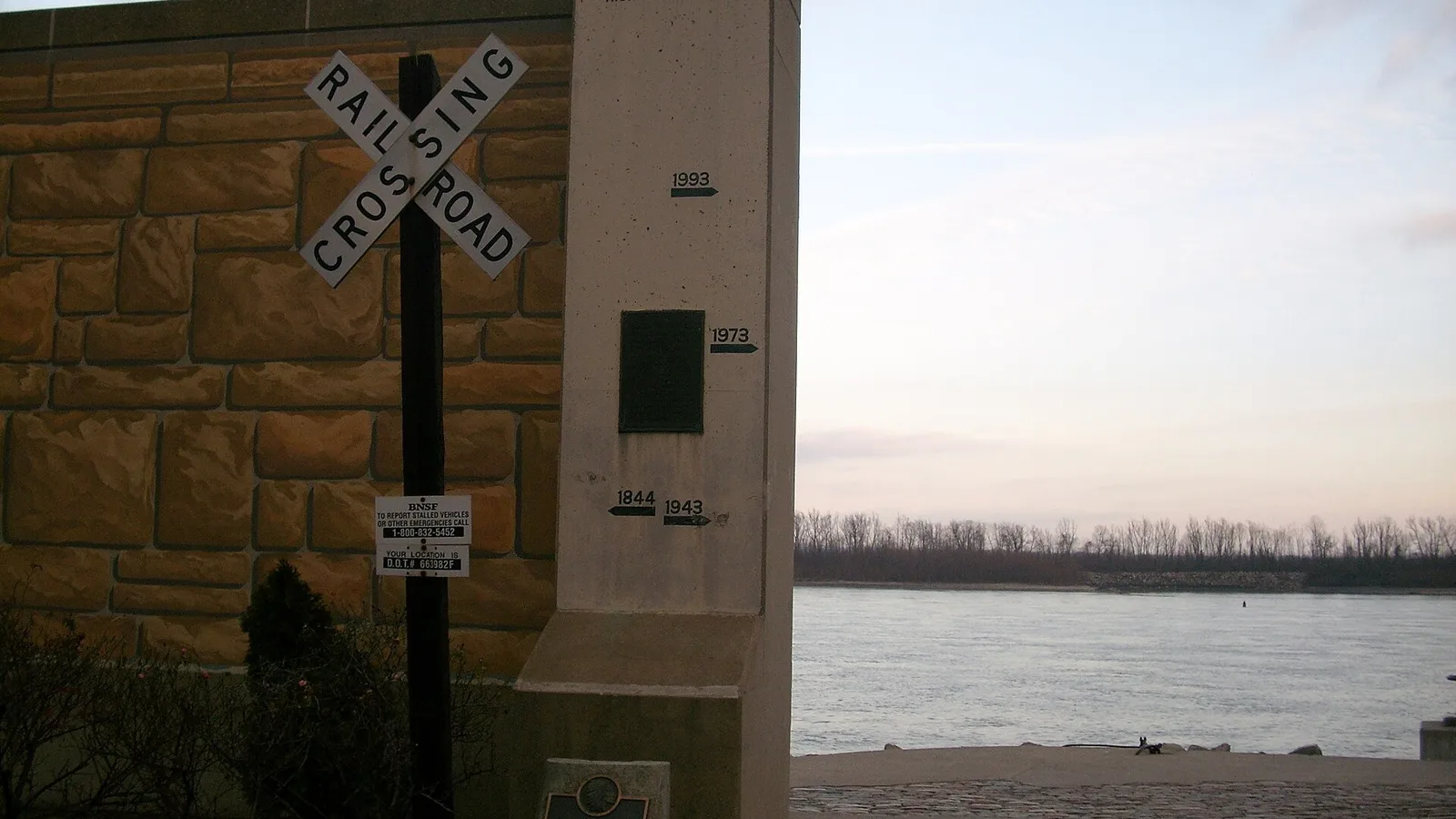
The Cape Girardeau floodwall protects downtown and the riverfront from the Mississippi River up to a 54-foot stage on the city's gauge (City of Cape Girardeau, Levee & Pump Stations, read October 2026). It is a floodwall and levee system. Gates close the openings in the wall when the river rises, and pumps move rainwater out.
Where the wall came from
Before the wall, the river reached downtown again and again. The City's history page says several destructive floods hit between 1927 and 1951, and sandbags could not hold the water back. Floodwaters closed riverfront businesses and covered the railroad tracks.
That changed in 1964. The U.S. Army Corps of Engineers completed a floodwall and levee system more than a mile long (City of Cape Girardeau, History, read October 2026). Today the City owns, operates, and maintains it, and murals of local history now cover the wall.
How the system works today
The City took over maintenance of the 8,460-foot levee system in 2008 from the Main Street and North Main Street Levee Districts. The system includes five closures and two pump stations, one at Mill Street and one at Merriwether Street (City of Cape Girardeau, read October 2026).
In normal conditions, stormwater drains to the river by gravity. Once the river nears flood stage, gravity flow stops working. Crews then staff the Mill and Merriwether pumping stations around the clock to push stormwater over the wall. The City states plainly that downtown would flood quickly if the pumps failed.
FEMA's guidance on levees says they "can help reduce the risk of flooding," but "they do not eliminate the risk" (FEMA, Living With Levees, read October 2026). Rain, creeks, and backwater can also put water where the river cannot.
River Stages: What Happens at Each Level
Each river stage on the Cape Girardeau gauge sets off a known step, from pump crews at 32 feet to gate closures between about 35.5 and 39.5 feet. The National Weather Service reports the gauge as CPGM7, "Mississippi River at Cape Girardeau." It sets action stage at 29 feet, minor flooding at 32, moderate at 37, and major at 42 (National Weather Service, gauge CPGM7, read October 2026).
The City and the Weather Service round a few gate stages differently. Both sets of figures appear below, each with its source.
| Stage (feet) | What happens | Source |
|---|---|---|
| 29 | Action stage. The area north of the Little River Diversion Channel begins to flood. | NWS CPGM7 |
| 32 | Flood stage. Minor flooding; the river backs into several creeks. The Mill and Merriwether pump stations are staffed 24 hours a day. | NWS CPGM7; City levee page |
| About 35.5 (NWS lists 36) | Public Works closes the gate at Water and Themis Streets. | City levee page; NWS CPGM7 |
| 37 | Moderate flood category begins. | NWS CPGM7 |
| About 37.8 (NWS lists 38) | The gate at Water and Broadway closes. Riverfront Park access is blocked. | City levee page; NWS CPGM7 |
| 39.5 | Railroad gates close in coordination with Burlington Northern; trains stop routing through downtown. | City levee page |
| 42 | Major flood category. Backwater from the Diversion Channel may cut off some structures in southern Cape Girardeau County. | NWS CPGM7 |
| 43 | The flood gate on North Main Street closes. | NWS CPGM7 |
| 48.86 | Record crest, January 2, 2016. | City levee page; NWS CPGM7 |
| 54 | The stage the levee system is built to protect to. | City levee page |
The Weather Service lists other high crests at the gauge. They include 48.49 feet on August 8, 1993, 46.36 feet on June 11, 2019, and 46.28 feet on May 3, 2011 (NWS CPGM7, read October 2026). These are past readings, not a forecast. The gauge page shows current and forecast stages if you want to follow the river yourself.
How Do You Check Your Cape Girardeau Floodplain Zone?
You check your Cape Girardeau floodplain zone by searching your exact address on the FEMA Flood Map Service Center and reading the zone on the current Flood Insurance Rate Map panel. The floodwall does not set zones. FEMA's map does, and it can draw different zones on neighboring lots.
Reading the result
- Zones that begin with A (such as A and AE) are Special Flood Hazard Areas, FEMA's high-risk zones (FEMA glossary, read October 2026).
- AE zones carry a base flood elevation. FEMA defines it as the water level from a flood with a 1% chance of reaching that height in any given year (FEMA glossary).
- X zones sit outside the Special Flood Hazard Area. Lower mapped risk is still not zero risk.
Save a copy of the map panel for your address. A buyer, a lender, and an insurer will each want the zone. Having it ready can save days of back-and-forth.
Citywide numbers versus your lot
Redfin's climate panel, using First Street data, lists 969 sites in Cape Girardeau at severe flood risk over the next 30 years. That is about 8% of the city (Redfin, September 2026). That figure is a model for the whole city. Your own zone, floor height, and claim history matter more to a buyer than any citywide share.
The 50 Percent Rule and the One-Foot Elevation Standard
Cape Girardeau's 50 percent rule says that once improvements over ten years reach half the market value, the work counts as a substantial improvement. Inside A and AE zones, the house must then meet the elevation standard. The rules sit in chapter 12 of the city code (Cape Girardeau Code of Ordinances, Municode).
What the code says
Section 12-4 defines the term this way:
“Substantial improvement means any combination of reconstruction, alteration, or improvement to a building, taking place during a ten-year period, in which the cumulative percentage of improvement equals or exceeds 50 percent of the current market value.” (Cape Girardeau Code Sec. 12-4)
Section 12-63(1) sets the standard for houses in A and AE zones. New or substantially improved residential structures "shall have the lowest floor, including basement, elevated to one foot above base flood elevation" (Sec. 12-63(1)).
Why a buyer cares
The ten-year window is the detail that catches people. Work done by the last owner can count toward the total, alongside the work a buyer plans next. A new roof, kitchen, and HVAC system can add up faster than expected.
Here is an illustrative example, not a real house. If a house is valued at $200,000, cumulative work of $100,000 over ten years reaches the 50 percent line. In an A or AE zone, that could turn a remodel into a project to raise the lowest floor or fill a basement.
A buyer planning major repairs will often ask the city about past permits and the base flood elevation for the lot. That question does not stop a sale. It shapes what a repair-minded buyer can pay. Our guide to selling a house that needs major repairs covers the repair side in more detail.
The 50 percent rule is triggered by permits for building and repair work. Selling the house does not trigger it. You are not required to elevate a house before you sell it.
Flood Insurance in Plain Terms
Flood insurance is a separate policy from homeowners insurance, and a buyer with a government-backed mortgage must carry it on a house in a high-risk flood area. FEMA states that "most homeowners insurance does not cover flood damage" (FEMA, Flood Insurance, read October 2026).
The National Flood Insurance Program
FEMA manages the National Flood Insurance Program, known as the NFIP. A new NFIP policy typically has a 30-day waiting period before it takes effect. FEMA lists exceptions, including coverage a lender requires and certain map changes.
How insurance changes the sale
- Monthly cost: A flood premium adds to a financed buyer's housing payment, which can change what loan they qualify for.
- Timing: A buyer who needs a quote before closing adds a step to the calendar.
- Records: Past claims, an elevation certificate, and repair receipts help a buyer get a quote and understand the house.
A cash buyer has no lender, so the mortgage rule does not apply to the purchase. A cash buyer still weighs flood risk and insurance cost when setting a price.
What Should You Disclose About Flooding in Missouri?
For flood disclosure in Missouri, share known flood history and water damage with the buyer in writing, even though no Missouri statute sets a general seller disclosure form. Past water entry is the kind of fact a buyer relies on when deciding what to pay.
The specific written rules
- Methamphetamine: Missouri requires a seller to disclose in writing known methamphetamine production on the premises (RSMo 442.606).
- Lead paint: Federal rules require a lead-based paint disclosure for houses built before 1978 (EPA, read October 2026).
Flood facts worth putting in writing
- Any time water entered the house, the basement, or a crawl space, with dates if you know them.
- Flood insurance claims and what they paid for.
- Repairs made after water damage, with permits and receipts.
- The FEMA zone and any elevation certificate you hold.
Putting known facts in writing can head off a dispute after closing. This guide is general information, not legal advice. A Missouri real estate attorney can review what your own situation calls for.
Flood History: The 1990s Buyouts
After the floods of 1993 and 1995, Cape Girardeau ran a voluntary buyout of flood-prone houses funded by FEMA and the state. The Southeast Missourian reported that 151 houses in the city were affected and FEMA found 114 eligible. The city had acquired 94 of them by April 1998 (Southeast Missourian, April 1998).
The program's funding reached $2,490,585, the same article reported. Earlier coverage named the Smelterville and Red Star areas among the first acquisitions (Southeast Missourian, December 1996). The city's coordinator explained the reasoning in 1998. Buying flood-prone houses once costs less than paying for damage after every flood.
That history matters for a seller today in one practical way. Buyers, appraisers, and insurers may already know which streets took water decades ago. Clear records about your own house answer their questions better than the neighborhood's reputation.
Ways to Sell a House in a Flood Zone in Cape Girardeau
You can sell a house in a flood zone in Cape Girardeau by listing it, by selling to a buyer who plans to renovate, or by selling as-is to a direct cash buyer. Each path fits a different house and timeline. For context, Redfin reports a median sale price of about $223,043 in Cape Girardeau for the three months ending September 2026, with a typical sale taking about 34 days (Redfin, September 2026).
List with an agent
If the house has no water history, sits in an X zone, or shows well, listing may bring the most money. Financed buyers will order an appraisal and, in a high-risk zone, a flood insurance quote. Expect questions, and have the map panel and records ready.
Sell to a buyer who plans to renovate
A renovating buyer will look hard at the 50 percent rule and the base flood elevation. If the plan crosses the line, their budget may include elevation work. That cost tends to show up in their price.
Sell as-is to a direct cash buyer
A direct cash sale moves the flood questions into one offer. Propcash is a direct cash homebuyer. We buy houses as-is, with no repairs, cleaning, or showings, and we sign the purchase contract as the buyer. We make one transparent, data-backed offer and show how we got to the number.
Sellers pay Propcash no fees or commissions, and you pick the closing date. Cash sales can close in as few as 7 days after the contract is signed. If listing would clearly serve you better, we'll say so. You can get a cash offer and compare it with your other options, or read our Cape Girardeau cash home buyer page for how the process works locally.
For a side-by-side look at every route, see the best ways to sell a house for cash in Cape Girardeau. If the house is empty or under a city order, our guide to selling a vacant or condemned house in Cape Girardeau covers those rules.
Why wait? Sell your house “as is” for cash today
Tell us about your house. We'll make you a cash offer based on local market data.
Let's chatFrequently Asked Questions
Is a Cape Girardeau house in a flood zone if it sits behind the floodwall?
The floodwall alone does not answer that question, because FEMA's Flood Insurance Rate Map sets the zone for each parcel. Search your exact address on the FEMA Flood Map Service Center and read the zone printed on the current panel. Zones that begin with A, such as A and AE, are Special Flood Hazard Areas. FEMA also notes that levees reduce flood risk but do not eliminate it.
Can you sell a house in a flood zone in Cape Girardeau as-is?
You can sell a Cape Girardeau house in a flood zone as-is, because no city rule requires you to repair or elevate it before a sale. The city's floodplain rules apply when someone builds, repairs, or improves the house. A buyer who plans major work takes on those rules, so the zone and any water history tend to shape the price and the pool of buyers.
Do you have to disclose flooding when you sell a house in Missouri?
Missouri has no statute that sets a general seller disclosure form, but known defects and past flooding should still be shared with a buyer in writing. Missouri law does require a written disclosure of known methamphetamine production (RSMo 442.606), and federal rules add a lead paint disclosure for houses built before 1978. A real estate attorney can tell you what your own situation calls for.
What is the 50 percent rule in Cape Girardeau's floodplain code?
Cape Girardeau's code calls work a substantial improvement when reconstruction, alteration, or improvement over a ten-year period adds up to 50 percent or more of the current market value (Sec. 12-4). In A and AE zones, a substantially improved residential building must have its lowest floor, including the basement, raised to one foot above base flood elevation (Sec. 12-63(1)). That standard can turn a large remodel into an elevation project.
Does a buyer need flood insurance for a house in a Cape Girardeau flood zone?
A buyer using a mortgage from a government-backed lender must carry flood insurance on a house in a high-risk flood area, according to FEMA. Most homeowners insurance does not cover flood damage, so flood coverage is a separate policy, such as one through the National Flood Insurance Program. A new NFIP policy typically has a 30-day waiting period, with some exceptions.
What was the highest Mississippi River crest at Cape Girardeau?
The highest river stage on record at Cape Girardeau was 48.86 feet on January 2, 2016, according to the City of Cape Girardeau and the National Weather Service gauge CPGM7. The City says its levee system is built to protect the area to a 54-foot stage. Flood stage on the Cape Girardeau gauge is 32 feet.